I’ve been working as a camping, hiking, and backpacking guide in Yosemite for the past four years and I’ve hiked all of these trails and more! With almost 1,200 square miles, and over 750 miles of hiking trails, here are some of the best hikes Yosemite National Park has to offer.
Table of Contents
22 Best Hikes in Yosemite National Park (According to a Backpacking Guide)

)
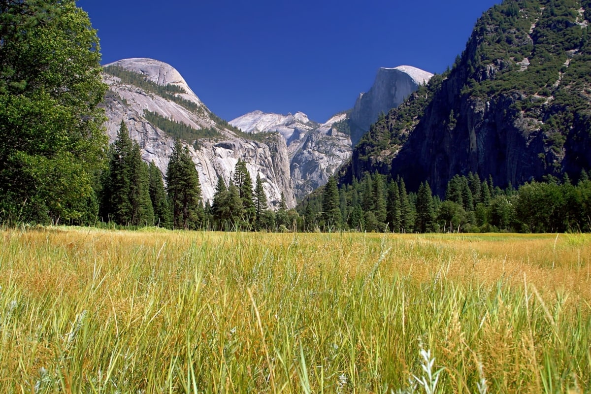
With the massive granite walls, majestic waterfalls, flowing rivers, gigantic boulders, and an impressive U-shaped valley, Yosemite National Park is home to beautiful geological features that make it the most visited national park in California.
I first visited Yosemite National Park about ten years ago on a family trip to hike Half Dome. I immediately fell in love with the beautiful landscape and 6 years later I found myself working as a camping, hiking, and backpacking guide in Yosemite in the park!
With almost 1200 square miles, and over 750 miles of hiking trails, here are some of the best hikes Yosemite National Park has to offer.
When to Go Hiking in Yosemite National Park
While it’s possible to hike in Yosemite National Park year-round, the most popular time to hike is from late spring to fall before the snow starts. However, each season offers different sites and hiking opportunities.
Spring
Late spring is generally when hiking season starts in Yosemite. Parts of the park, including Tioga Road and Glacier Point Road are still closed for the season, due to snow; however, there are plenty of hikes starting from Yosemite Valley’s floor.
This is also the best time of the year to enjoy the waterfalls at their fullest! The first time I visited the park in the spring, the roaring falls poured over the edge of the granite cliffs rising over 2,000 feet above me. I felt so small. The mist of the waterfalls sent a cool spray in contrast to the warm valley temperatures. It was an incredible experience and only possible on an early spring visit.
Summer
Summertime in Yosemite offers the most accessibility throughout the park (and the most sweat—pack that sunscreen)! Yosemite Valley gets very hot during summer months, so this is the best season for higher altitude hikes starting from Tioga Road or Glacier Point Road.
As the snow is generally melted by mid to late summer, this is the ideal time to access the high country alpine lakes and peaks.
Fall
Fall is still a great time to hike in Yosemite National Park. Until the first snowfall, you have almost unlimited options of where you want to explore.Plus, this is when Yosemite Valley starts to cool off again.
Although the waterfall hiking trails remain open, be prepared for very little water. Most water tends to dry up during the summer months. But don’t worry, the fall leaf colors and comfortable hiking temperatures make up for it!
Winter
By winter the high elevation hikes in the park close. This includes the road to Glacier Point and any trails around Glacier Point and Tioga Road.
During the winter you’ll want to stick to hiking in Yosemite Valley. It’s not uncommon to get snow so come prepared with warm clothing and tire chains for your car to get around! And if you’re not familiar with how to put chains on, practice ahead of time because chain patrol will charge you $40!
Yosemite Hikes Difficulty
In this guide, the best hikes in Yosemite are broken down by the length of time; short hikes, half-day hikes, full-day hikes, and multi-day hikes. Although they take different amounts of time to complete for every person, this provides a good estimate.
And be aware, just because a hike is short, doesn’t mean it will be easy! Every hike ranges in physical difficulty and varies in each category. As an experienced guide who has seen the terrain of all these hikes, I’ve created difficulty levels to help you navigate which hikes are best for you.
The hikes are ranked as so:
Easy: The trail is primarily flat, most likely paved, and suitable for strollers, wheelchairs, and all visitors.
Moderate: There is some elevation gain on these trails or it might be a long hike but it’s still doable by many visitors, including if you don’t hike often.
Moderately Strenuous: More elevation gain, rocky terrain, the hike will last at least a few hours. Hiking experience is recommended.
Strenuous: There is significant elevation gain, the terrain can be rough, the hike is long, and it is difficult. You should have previous hiking experience.
Very Strenuous: The hike is very challenging. There is a lot of elevation gain and it is hard. You should definitely be an experienced hiker.
So…ready to get hiking?
Short Hikes in Yosemite National Park
There are plenty of short hikes in Yosemite National Park that take about an hour to hike and are suitable for all visitors. Many of these short hikes are paved and offer views of some of the most iconic spots in the park.
Whether you’re a first-time hiker or a hiking veteran, these are some of the best hikes in Yosemite.
-
Sentinel Meadow & Cooks Meadow Loop

- Distance: 2-miles
- Time: 1 – 2 hours
- Elevation Gain: 70 foot gain
- Difficulty: Easy
As you drive into Yosemite Valley after passing Bridalveil Falls and El Capitan, you’ll reach an opening of meadows, high granite walls, and catch sight of the impressive Yosemite Falls. One of the best ways to enjoy this area is by parking your car and walking!
Park your car at the Yosemite Valley Lodge and hit the trail. The trail is paved and suitable for all visitors. Stay on the lookout for wildlife, including mule deer, black bears, squirrels, and abundant birdlife.
Also, bring your camera because you’ll have stunning views of the valley the whole way! The trail also loops you across the Merced River where there are numerous beaches to lie out and relax or go for a swim. This is one of my favorite things to do in Summer!
Even avid hikers should check out the Sentinel Meadow and Cooks Meadow Loop. It’s a great rest day activity and one of the best hiking trail options to enjoy Yosemite Valley.
-
Lower Yosemite Falls Trail
Photo credit: the_tahoe_guy - Distance: 1.2 miles round trip
- Time: 30 minutes – 1 hour
- Elevation Gain: 60-foot gain
- Difficulty: Easy
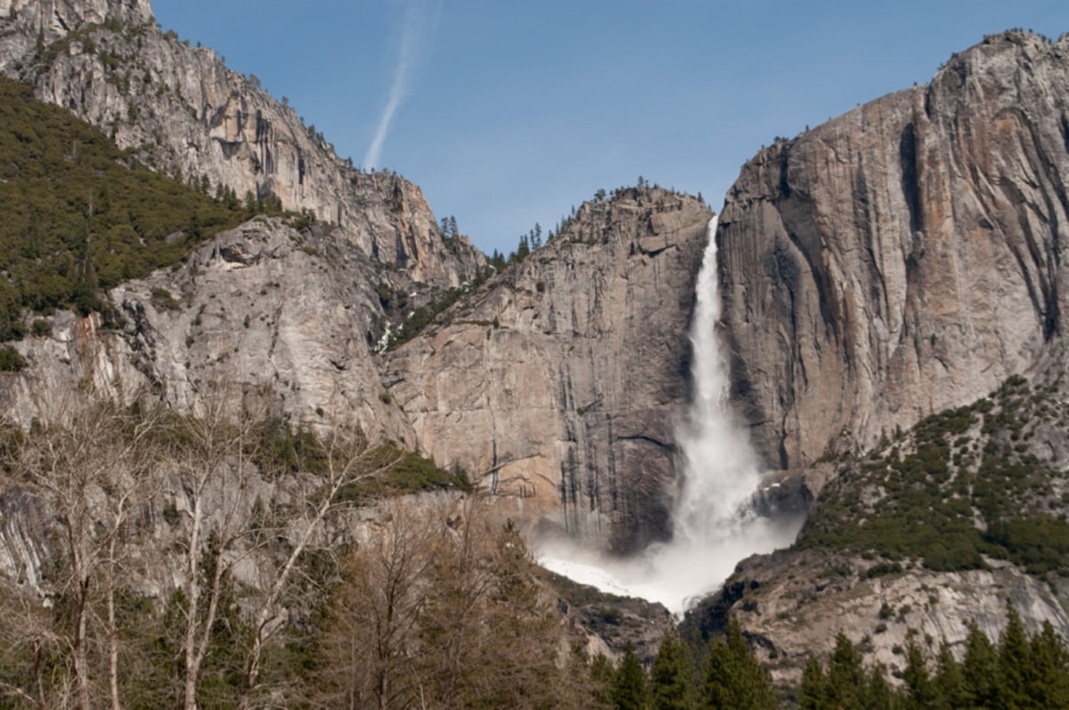
One of the first sights you see when you drive into Yosemite Valley is Yosemite Falls. These are the tallest falls in North America, dropping 2,425 feet!
Head to the Lower Yosemite Falls Trailhead to enjoy spectacular views of the powerful rushing water. You’ll catch glimpses of both the upper and lower falls. This trail is suitable for all hikers and is a paved path so it’s accessible with strollers and wheelchairs.
As you get out closer to Yosemite Falls, it’s tempting to hike out on the giant boulders; however the boulders are very slippery, which has led to serious injuries. Remember to always stay on trial when hiking in Yosemite!
The Lower Yosemite Falls Trail is one of the best hikes in Yosemite, and where I bring my family and friends when they visit the park! Keep an eye out for the beautiful Stellar Jay, which is a popular bird in this area.
**Note that the falls flow best in the spring to early summer after the snow melts. During low snow years, Yosemite Falls may stop flowing by the middle of summer.
-
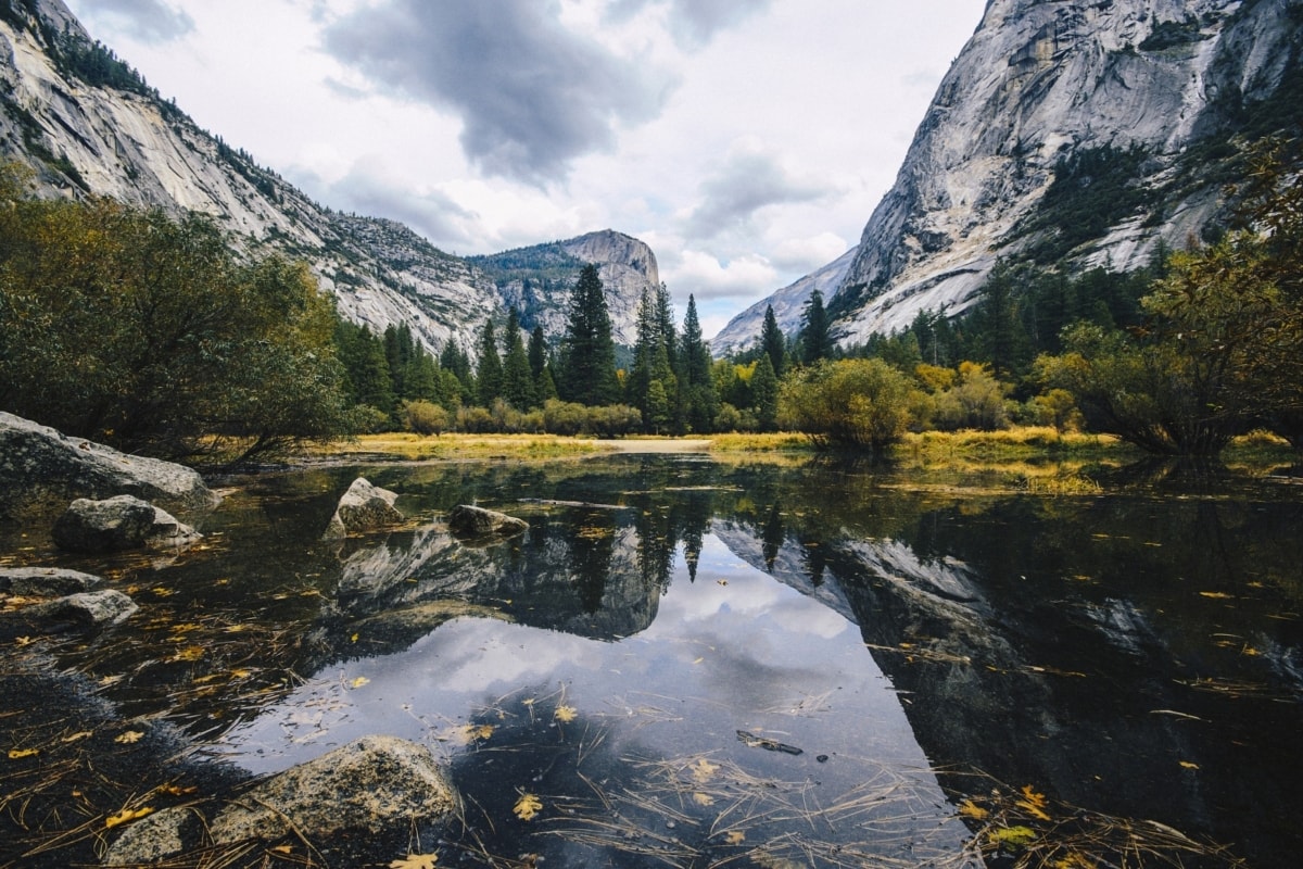
Mirror Lake
- Distance: 2-miles round trip
- Time: 1 hour
- Elevation Gain: 115-foot gain
- Difficulty: Easy
Mirror Lake is another paved, easily accessible trail. When the water level is high enough, you’ll see breathtaking reflections of Half Dome right in Mirror Lake! It’s really one of my favorite views to this day.
Contrary to its name, Mirror Lake is actually not a lake, rather it’s a large pool at the end of Teyana Creek. Flowing all the way from Tenaya Lake and down Tenaya Canyon, it’s where the water from Yosemite’s High Country finally meets the valley.
The easy walk out to Mirror Lake brings you as close as possible to the base of Half Dome and when the water level and lighting is right, you’ll see the incredible reflections of the surrounding granite walls.
Mirror lake is one of the most popular swimming spots in the park. I recommend visiting this spot early in the season before the water level decreases and Mirror Lake dries up.
If you want to extend your hike, continue on the trail up Tenaya Canyon. Their is an established trail, but take note that it is a rockier path!
The Mirror Lake trailhead is located at shuttle stop 17 if you take the shuttle through Yosemite Valley.
-
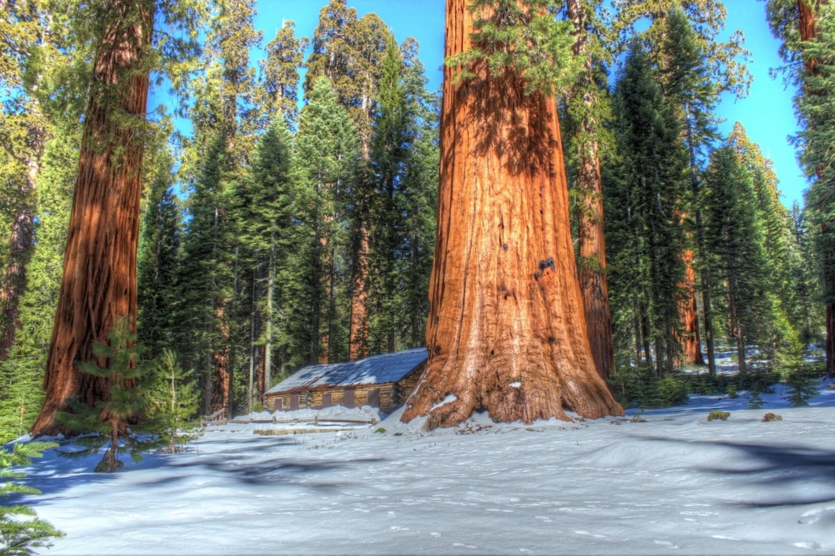
Mariposa Grove Grizzly Giant Loop
- Distance: 2-mile loop
- Time: 1 hour
- Elevation Gain: 350 foot gain
- Difficulty: Moderate
Mariposa Grove of Giant Sequoias is home to the largest trees in the park. The Giant Sequoias are likely the largest trees you’ll ever see. In fact, the Giant Sequoias grow to be the largest living organism on Earth, in terms of their cubic volume!
The 2-mile option is my favorite trail because you can see the highlights Mariposa Grove has to offer. There is also a very short 0.3-mile Big Trees Loop or an extended 7-mile Mariposa Grove Trail option.
Along the Grizzly Giant Loop, you’ll see the California Tree Tunnel—a previously carved out Sequoia that vehicles were driven through. Today, the tree still stands tall and is growing and actually healing itself! Nature is pretty dang cool.
You’ll also see the Grizzly Giant, the largest tree in Yosemite, with a 30-foot diameter and about a 90-foot circumference. It’s estimated to be around 1,800 years old.
You’ll also see some other notable trees, the Bachelor, Three Graces and the Fallen Monarch.
To get to Mariposa Grove you’ll have to take a Yosemite National Park shuttle from the Mariposa Grove parking lot, as parking is limited to handicap only at the trailheads. These shuttles run every 10-15 minutes during the summer.
-
Glacier Point Trail
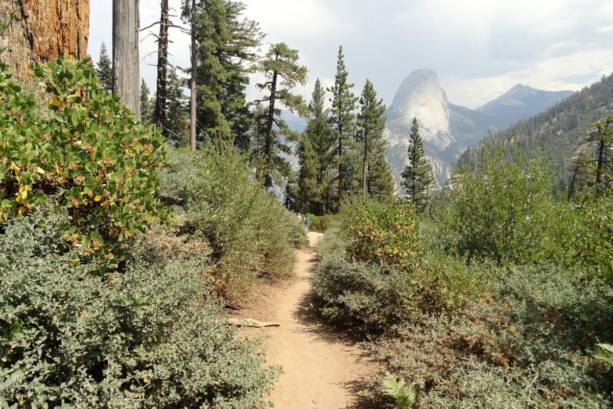
Photo credit: Fabio Achilli - Distance: < 1 mile
- Time: 1 hour
- Elevation Gain: 150 foot gain
- Difficulty: Easy
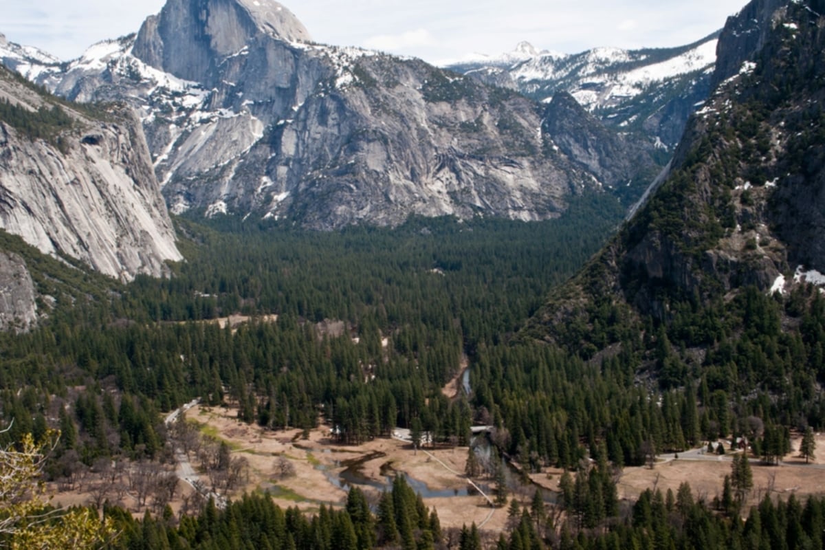
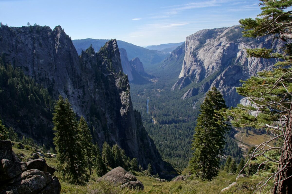
Yosemite Glacier Point is my favorite drive up viewpoint in the park, and the most expansive. From Glacier Point, you can see nearly one-third of the whole park. From the top of Glacier Point, you’ll look down on El Capitan and Yosemite Falls, Half Dome, Mount Lyell, and Mount Hoffman, as well as the Clark Range, Vernal Fall, and Nevada Fall.
Itis a paved trail with many signposts to learn about the landscape and how it was formed. Crazy enough, it’s called Glacier Point because millions of years ago, glaciers covered the land up that high!
It’s the perfect spot for all visitors as it is stroller and wheelchair accessible. It’s also an incredible spot to photograph the sunset or the Milky Way if you plan to visit at night.
Parking is limited up here so arrive early or visit during the weekdays to avoid the biggest crowds.
-
Yosemite Valley Loop Trail
- Distance: 2-mile – 11-mile loop
- Time: 1 – 5 hours
- Elevation Gain: Flat
- Difficulty: Easy to Moderate
The Yosemite Valley Loop Trail is a paved trail that follows the valley floor. You can hike as little or as much as you want, and it’s pretty flat the whole way. It is suitable for all hikers as well as strollers, wheelchairs, and bicycles.
No matter where you are along this trail you’ll enjoy views of the meadows, often thriving with wildlife. You’ll also have an impressive view of Half Dome, and you’ll criss cross around the Merced River.
You’ll also catch views of both Upper Yosemite Falls and Lower Yosemite Falls, which offer impressive views from different angles, and being the main trail through the valley, you’ll pass by park gift shops, the Yosemite National Park visitor center, Yosemite Village, Yosemite Lodge, and the Ahwahnee Hotel.
Half-Day Hikes in Yosemite National Park
If you’re hoping to get in a little hiking but still want to have time to relax by the river or check out the visitor center, these are some of the best half-day hiking trails in Yosemite.
-
Mist Trail to Vernal Falls and Nevada Falls
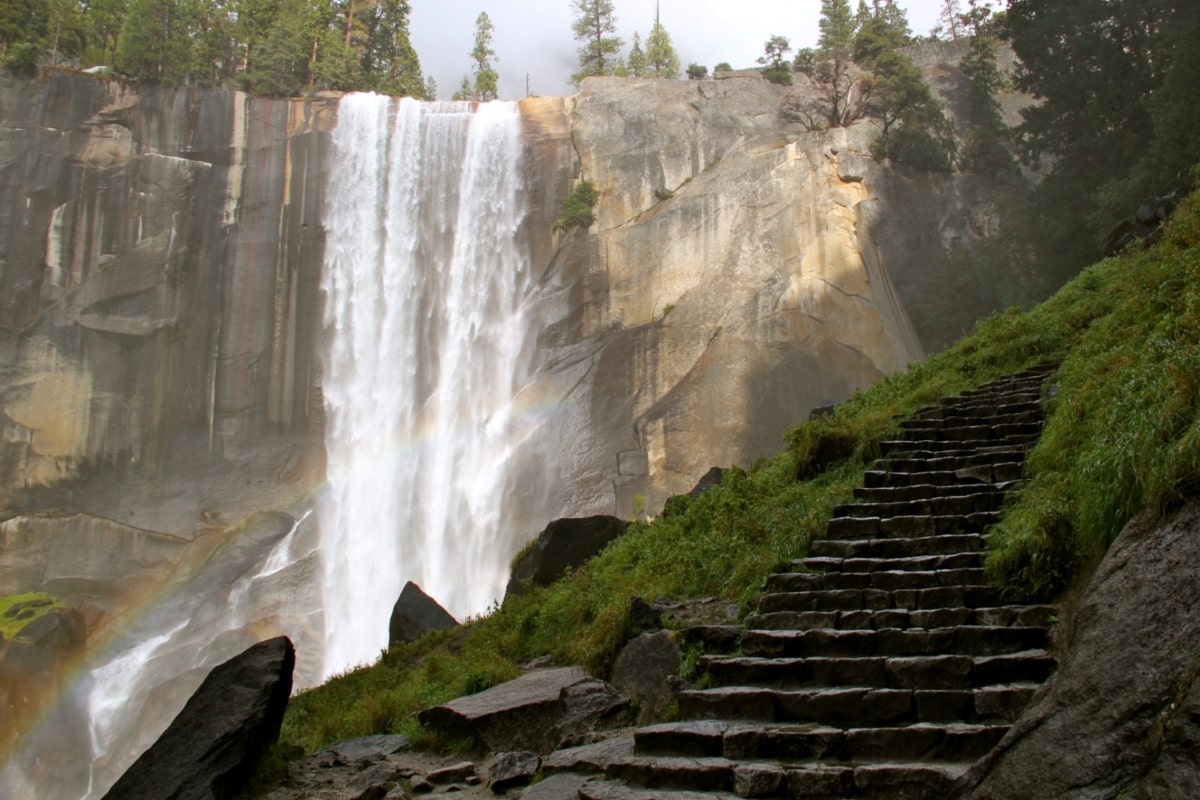
Photo credit: David Fulmer - Distance: 6 miles round trip
- Time: 3 – 4 hours
- Elevation Gain: 2,160 foot gain
- Difficulty: Strenuous
If you’re visiting in the spring to early summer be sure to check out the Mist Trail to Vernal Falls and Nevada Falls. In the early season after the snow melts, these two waterfalls are at their prime and cannot be missed.
You’ll wind your way past the fast-flowing Merced River while passing rocky walls and boulders along a paved path. When you reach the footbridge to cross the Merced you’ll have spectacular views of Vernal Falls.
Continuing on is where the trail gets tough. Bring a rain jacket because you’re sure to get misted by the powerful flowing water. There’s a reason it’s called the Mist Trail!
You’ll continue your way up to some steps until you reach the top of Vernal Falls. Then it’s on to Nevada Falls, another section of steep rocky blocks. When you get to the top of Nevada Falls, you’ve done the hard part! The views looking out through the canyon and hearing the roaring waterfalls certainly make this trail worth the effort.
There are two options to hike down. You can go down the Mist Trail, the same way you came up, but it’s a bit more crowded and hard on the knees. The best option is to take the John Muir Trail down, which has less crowds and a more gradual descent.
The full hike to Nevada Falls is about 6 miles round trip, but you can cut the hike in half by turning around at the top of Vernal Falls. There’s even a very short option to the footbridge below Vernal Falls that is about 1.5 miles round trip. As one of the best hikes in Yosemite, all hikers can enjoy some sections of the Mist Trail!
-
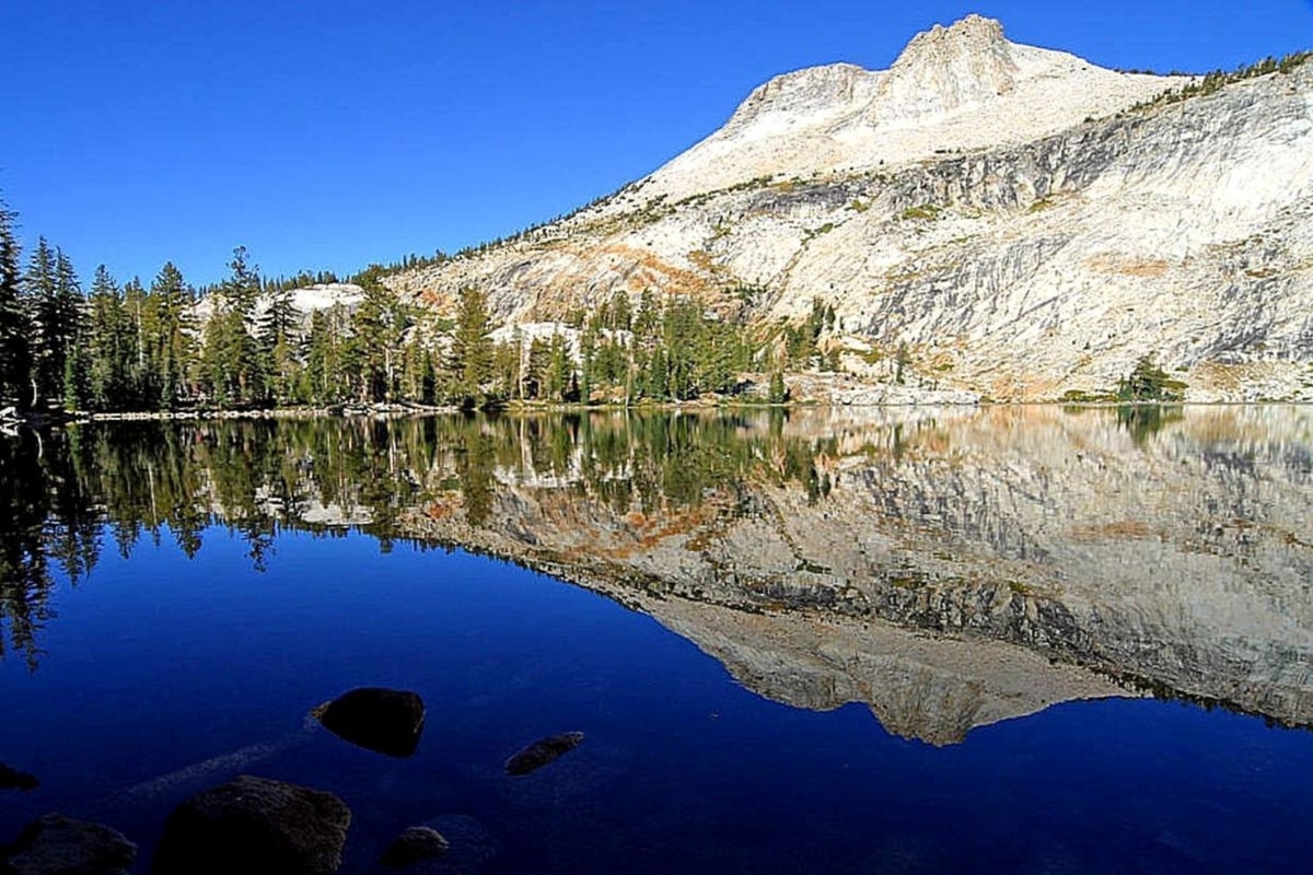
Cathedral Lakes Trail
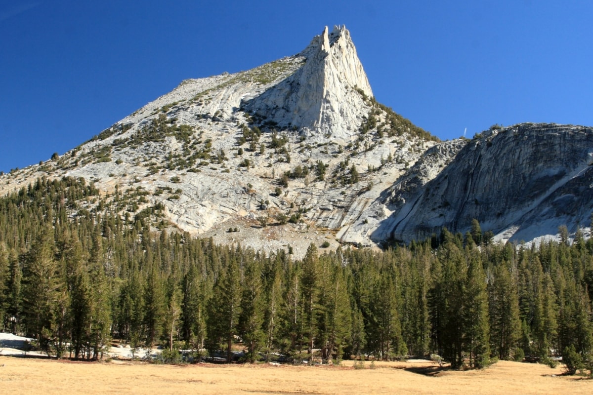
Photo credit: Frank Kovalchek - Distance: 8.5 miles round trip
- Time: 4 – 6 hours
- Elevation Gain: 1,600 foot gain
- Difficulty: Moderately Strenuous
Located on Tioga Road just across from Tuolumne Meadows, the Cathedral Lakes trail is a great half-day hike in Yosemite National Park. The full trail to Upper Cathedral Lake is just over 8 miles round trip, but if you only want to visit Lower Cathedral Lake, it’s about 7 miles.
Cathedral Lakes are some of the most impressive, easily accessible alpine lakes in the park. From the lakes, you’ll view reflections of the high Yosemite peaks surrounding the area.
Cathedral Peak, Echo Peak, and Tresidder Peak all stand over 10,000 feet tall and circle around the lakes. It’s a beautiful spot to photograph or hike in and enjoy a picnic.
My favorite thing to do on this hike is walk out to the southern edge of Lower Cathedral Lake and sit on the rocks where the water flows down. From here you can look down and catch sites of Tenaya Lake, the largest lake in Yosemite!
-
Sentinel Dome & Taft Point Loop
- Distance: 5-mile loop
- Time: 2.5 – 4 hours
- Elevation Gain: 1,120 foot gain
- Difficulty: Moderate
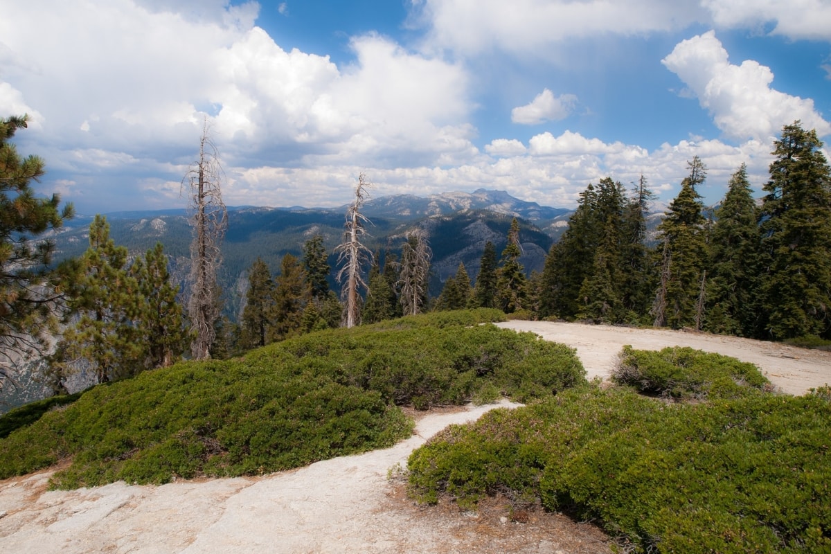
The Sentinel Dome and Taft Point Loop offer some of the most spectacular views of the park. From these 2 trails, you’ll enjoy sweeping views of over one-third of Yosemite National Park. It’s the best moderate hike option for the biggest rewards.
While Glacier Point is one of the park’s most famous viewpoints, hiking out to Sentinel Dome and Taft Point will help you avoid the crowds. The whole trail is a 5-mile loop. It’s possible to hike to just the dome or the point, but to experience everything Yosemite has to offer, I’d recommend both.
These trails are well established; however, the ends of both trails have a steep, calf-burning incline. At Sentinel Dome, you’ll have impressive views of Yosemite Falls, Mount Hoffman, Vernal Falls, Nevada Falls, Mount Lyell (the highest point in the park), and more!
After Sentinel Dome, simply hike down a bit to Taft Point. The first time I did this hike, my eyes definitely widened as I realized I’d be hiking along 3,000-foot cliffs. From there you’ll look down on the Yosemite Valley floor and enjoy amazing views of El Capitan!
-
Columbia Rock
- Distance: 2 miles
- Time: 1 – 2 hours
- Elevation Gain: 1,000 foot gain
- Difficulty: Strenuous
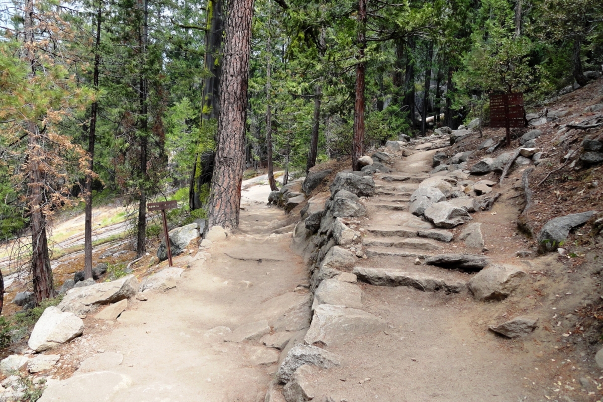
Columbia Rock is one of the best half-day Yosemite Hikes. While it’s only a 2-mile round trip hike, it gains about 1,000 feet of elevation, making it quite strenuous. Steep blocky stairs make up a good portion of this trail, followed by steep sandy switchbacks and slick rocks where you must watch your footing.
Columbia Rock is actually located about one-third of the way up the Upper Yosemite Falls trail. Along the way, you’ll have incredible views looking out at Yosemite Valley and Half Dome. It’s my favorite spot to enjoy lunch while overlooking the park highlights!
If you have extra time, hike just past Columbia Rock where you’ll stand at the base of Upper Yosemite Falls and catch a little mist (perfect for those hot Yosemite summer days I know all too well)
The hike up to Columbia rock is covered in trees for part of the way then it’s very exposed to the sun so either start very early in the day or in the late afternoon to avoid the strongest of the sun’s heat.
This is one of the best hikes in Yosemite if you’re in good shape and looking for a quick challenge but still want to check out other parts of the park throughout the day.
-
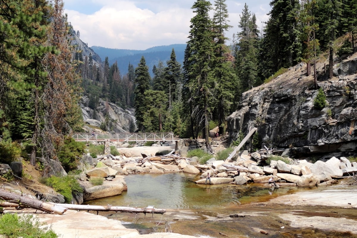
Wapama Falls (Hetch Hetchy)
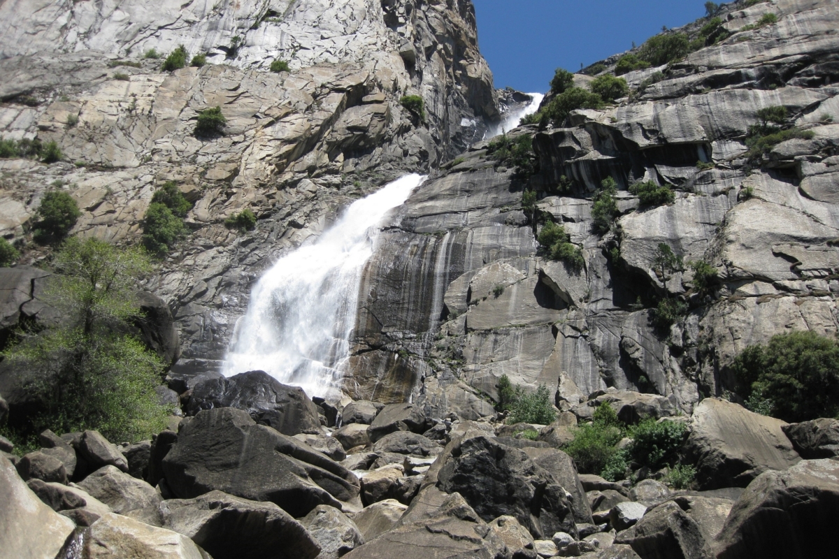
- Distance: 5.5 miles round trip
- Time: 3 hours
- Elevation Gain: 1,000 foot gain
- Difficulty: Moderately Strenuous
The Wapama Falls are located in the Hetch Hetchy Reservoir part of Yosemite. Hetch Hetchy is the large reservoir at the end of the Tuolumne River where water has been dammed. This reservoir sends water all the way back to the Bay Area!
Wapama Falls flow from the side of the granite cliffs, down into Hetch Hetchy. This part of Yosemite is very different looking from the rest of the park, and even has a separate entrance just outside the northwest park entrance.
The hike to Wapama Falls is just over 5 miles round trip. The terrain of the trail is rocky and is considered moderate, but the intense heat and sun exposure make it feel a lot more tiring than that. This half-day hike is best to start early to avoid the high temperatures.
At the start of the hike you’ll walk across the large dam where you can read about its history, construction, and the hydroelectric power generated from the dam. Then you’ll pass through a long, carved tunnel that leads to the trail.
Along the way, you’ll have amazing views of the whole reservoir and surrounding peaks. As this is a protected watershed, there is no swimming or drinking in this water.
-
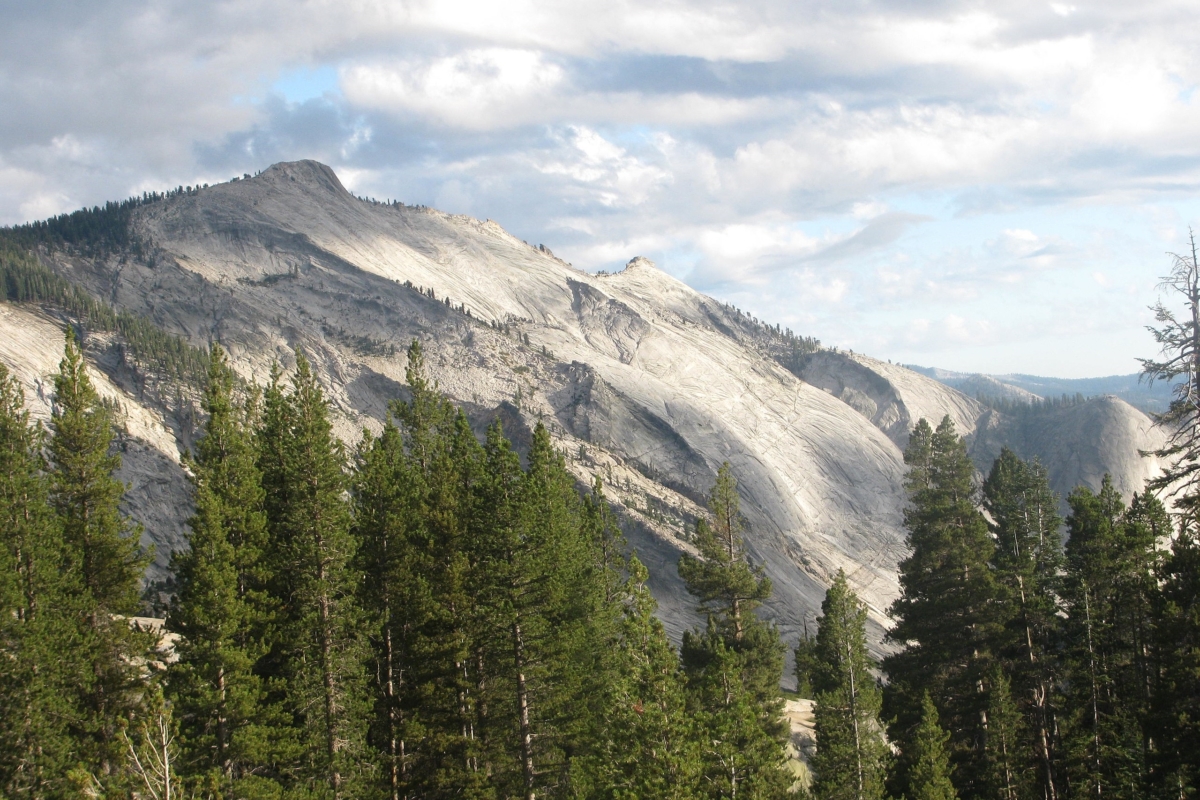
Lembert Dome
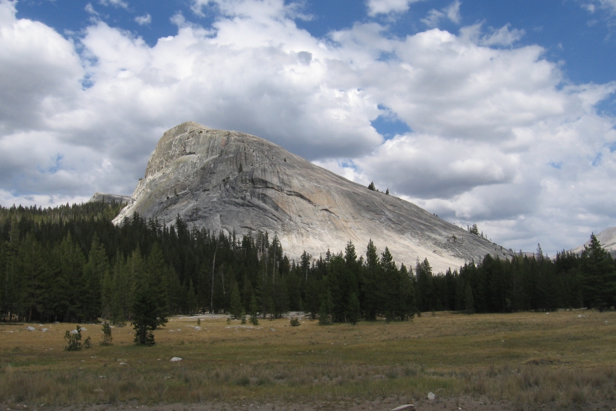
- Distance: 2.8 miles
- Time: 2 – 3 hours
- Elevation Gain: 800 foot gain
- Difficulty: Moderate
Head up to the high country to hike Lembert Dome for a Half Dome-like experience, minus the cables.
Lembert Dome is a large granite dome on the east side of Tuolumne Meadows. It’s the perfect option for a hike starting in the forest and then climbing out of the alpine to a sheer granite dome. From there you’ll carefully make your way up my favorite part: a dome about 150 feet high that overlooks Tuolumne Meadows.
I’ve had my fair share of friends freak out while ascending the dome because it looks pretty intimidating, but with careful foot placement and good traction on your shoes, you’ll make it through the exposure just fine.
From the top you’ll see the Tuolumne River snaking through the area, surrounded by Yosemite’s rugged Sierra peaks. This is one of the best hikes in Yosemite especially when you are spending a day exploring the high country.
-
May Lake & Mount Hoffmann
- Distance: 2.5 miles round trip to May Lake; 6 miles round trip to Mount Hoffmann
- Time: 1.5 – 4 hours
- Elevation Gain: 500 foot gain to May Lake; 1,900 foot gain to Mount Hoffmann
- Difficulty: Moderate to May Lake, Strenuous to mount Hoffmann
The May Lake and Mount Hoffmann trail is located off of Tioga Road in the high country of Yosemite National Park. May Lake is located just a mile up the trail and Mount Hoffmann is a couple of steep, rocky miles past that.
The trail to May Lake gains about 500 feet in just over a mile. This part of the trail is well established and considered moderate. The lake offers gorgeous views where you can see Mount Hoffmann reflected in the lake on a clear day. May Lake is also a High Sierra Camp making it a popular campground.
If you’re in for stepping up the hiking difficulty, continue up to the summit of Mount Hoffmann, the geological center of Yosemite. Standing at 10,855 feet tall, you’re sure to feel the altitude.
The trail to the summit is established for part of the way but you’ll reach a scree-like field that will require following the rock cairns to find your way;some map navigation helps! This part is very tiring and exposed—make sure you pack plenty of water!
After you get through the hardest part you’ll see the trail again which mellows out over some very gradual terrain until you make the final scramble up the blocky rocks to the summit.
The exposure seems intimidating but it’s worth it, and at the top you’ll likely be treated with marmots. You’ll also enjoy the spectacular views of Yosemite’s Half Dome, Clouds Rest, Tenaya Lake, and more!
Full-Day Hikes in Yosemite National Park
With the varying elevations throughout Yosemite National Park come a variety of full-day hiking options that are strenuous, but worth the effort. These hikes are likely to take the full day, especially Half Dome, and it is recommended to get an early start on all of them.
The earlier you start, the more you’ll avoid the large crowds and heat that come as the day goes on. Make sure to pack a lot of water and a filter as you’ll be out all day exploring some of the best hiking trails Yosemite has to offer.
-
Half Dome
- Distance: 14 – 16 miles round trip
- Time: 10 – 12 hours
- Elevation Gain: 5,200 feet gain
- Difficulty: Strenuous
Half Dome is one of the most iconic and popular rock formations in Yosemite National Park. Rising almost 5,000 feet above the Yosemite Valley floor, at 8,839 feet of elevation, the panoramic views from the summit are like no other.
Half Dome is not a beginner hike. With intense elevation gain, it is a full-day venture. Plan to start before sunrise as it takes an average of 10 – 12 hours to complete. While the Half Dome trail is very established you’ll encounter many sets of thigh-burning, blocky steps.
Most people start their Half Dome hike from the Mist Trail and head up past Vernal Falls and Nevada Falls. This is the most direct route.
After you finally make it to the base of the dome you’re in for the real adventure: the Half Dome cables. Here you’ll climb up a 45-degree angle slab using the Half Dome cables to brace your way up the final 400 feet. Let’s just say it’s no easy feat for those afraid of heights (don’t look down)!
It’s best to wear gloves so you don’t cut your hands along the cables. Gardening gloves with rubber on the palm side or leather gloves work best.
When you get to the summit you’ll have sweeping views of the park, including North Dome, Yosemite Valley, Yosemite Falls, Glacier Point, the Merced River, and Clouds Rest. It’s no surprise why Half Dome is one of the best hikes in Yosemite and you’ll certainly feel the rewards of a 15-mile day of hiking.
**You must receive permits ahead of time to ascend the cables on the Half Dome hike. There is a preseason lottery as well as daily lotteries. Permits are very limited but visit recreation.gov to find out more information about how to reserve a permit.
-
Upper Yosemite Falls Trail

- Distance: 7.5 miles round trip
- Time: 4 – 7 hours
- Elevation Gain: 3,200 foot gain
- Difficulty: Strenuous
Hiking to the top of Yosemite Falls is a tiring but rewarding experience. From Yosemite Valley, you’ll gain just over 3,000 feet in elevation. About a third of the way up you’ll pass by your first memorable viewpoint, Columbia Rock. There you’ll catch glimpses of the tall granite walls across the valley and Half Dome standing tall.
Then you’ll slightly descend and reach the base of Upper Yosemite Falls cascading into Lower Yosemite Falls. You’ll likely receive a shower of mist along the trail here so watch out because the rocks are slippery!
Then you’ll have rocky switchbacks the remaining 2,000 feet up. It gets tough but as one of the best hikes in Yosemite, it’s worth it. The trail doesn’t have the best footing so keep that in mind.
When you reach the top, you’ll have views of the top of the falls, and the Yosemite Valley floor. My favorite spot from the top of the falls is Yosemite Point, located just off of the Upper Yosemite Falls Trail. Yosemite Point will offer the best view of Yosemite Valley from this trail as well as great views of Half Dome and Clouds Rest.
If you have extra time and energy, add an additional 3 miles of hiking and head over to the summit of El Capitan.
Because of the exposure on this hike, it’s recommended to start really early before sunrise or after 1p.m. when parts of the trail start to go into the shade.
-
Clouds Rest
- Distance: 14 miles round trip
- Time: 6 – 8 hours
- Elevation Gain: 3,160 foot gain
- Difficulty: Strenuous
If you want to experience incredible views across Yosemite while avoiding the most popular hiking trails, check out Clouds Rest. Clouds Rest sits at 9,931 feet in elevation and offers panoramic views of Yosemite National Park.
You’ll start the Clouds Rest hike at the Sunrise Lakes trailhead located off of Tioga Road near Tenaya Lake. The trail takes on gradual ascents and small descents on the way up.
You’ll finish making your way out to Clouds Rest by crossing boulders with exposure on both sides of you. This part of the hike can be intimidating for many, so come prepared with good shoes and ascend carefully.In the end, you’ll be rewarded with the incredible vistas and catch sites of El Capitan, North Dome, Tenaya Lake, Sentinel Dome, Mount Hoffman, Sunrise Lakes, and Yosemite Valley. If you bring binoculars, you’ll even be able to look out on Half Dome and see hikers ascending the cables!
This is a strenuous hike for most of the way and there is little to no water access so pack at least 3 liters of water per person.
-
Four Mile Trail
- Distance: 4.6 miles one way, 9.2 miles round trip
- Time: 3 – 7 hours
- Elevation Gain: 3,600 foot gain
- Difficulty: Strenuous
With the trailhead starting across from El Capitan Meadows, The Four Mile Trail will take you 3,600 feet up a switchback trail to the rim of the valley. The trail ends at the iconic Glacier Point.
Along the Four Mile Trail, you’ll take in the magnificent views of Yosemite Falls, El Capitan, and Yosemite’s Three Brothers. As you reach the top your views will include North Dome, Half Dome, and Mount Hoffman.
The Four Mile Trail is very exposed so it’s recommended that you start early before you’re hiking in full sunlight. Also, bring plenty of water as there are minimal to no stream crossings this whole way.
There is the option to hike this trail point-to-point instead of out-and-back. If you’re with friends, you can start at the top of Glacier Point Road and hike down to the Yosemite Valley floor, and get picked up. Or you can make the long ascent from the valley and friends can meet you at the top along Glacier Point Road.
-
Panorama Trail
- Distance: 9 miles round trip
- Time: 4 – 6 hours
- Elevation Gain: 2,250 foot gain
- Difficulty: Strenuous
The Panorama Trail starts and ends at Glacier Point and is an out-and-back hike that’s 9 miles round trip. From Glacier Point, hikers start with views of Half Dome and the Clark Range then descend down along Ililloutte Creek to Ililloutte Falls.
Next, climb back up to catch views of the Mist Trail Waterfalls including Vernal Fall and Nevada Fall while wandering through a forest filled with cedars and pines.Then it’s a 4.5-mile hike back out to the trailhead at Glacier Point.
While this is the full round trip route for the Panorama Trail, it also connects with many other trails. Some people hike the Panorama Trail to connect to the trail up Half Dome. Others take it down to the Mist Trail then drive or shuttle from Glacier Point to the valley.
If you choose to hike down, make sure you have hiking poles! By the time you get to the bottom, your legs will be wobbly and shaking from the long descent to the valley, and poles will help with taking the weight off your legs on the hike down.
Multi-Day Hikes in Yosemite National Park
With several hundred miles of trail in the park, Yosemite offers a variety of multi-day backpacking options. Carrying a 35-pound backpack with all your sleeping gear, food, and clothing makes this a challenging adventure, but there are truly routes catered to any skill level.
All overnight backpacking wilderness trips require permits and you must obtain them ahead of time. Visit recreation.gov to find out more information. Permits go on sale about 6 months out and fill up very quickly so plan your trip early!
-
Yosemite North Rim Trail
- Distance: 15 miles
- Time: 3 days
- Elevation Gain: 7,000 feet
- Difficulty: Strenuous
The Yosemite North Rim Trail is a great hike for beginner backpackers. It follows along the north rim of Yosemite Valley offering incredible views of Yosemite National Park the whole way.
There are two spots to start this trail. One option starts from Yosemite Valley and takes you up to the rim via the Upper Yosemite Falls Trail, passing Columbia Rock. If you want to avoid the steepest elevation gain on your first day, you can start from Tioga Road and hike in towards Yosemite Creek.
Spend your first night camping along Yosemite Creek, about a half-mile back from the roaring top of Yosemite Falls. While up there check out views from Yosemite Point, and if you have extra energy, hike over to the top of El Capitan!
Day 2 is my favorite day of the trail because you’ll follow along the rim of the valley the whole day. From there you’ll have incredible views of Half Dome pretty much the whole way. You’ll also glimpse Clouds Rest, Vernal Fall and Nevada Fall.
Around midday you’ll end up near North Dome,and if you have extra time, hike out on North Dome to get some even more incredible views! That’s also where you get some of the most mighty views of Half Dome towering over the Yosemite Valley floor.
Then it’s onward along the rim. You’ll start your descent along the Snow Creek Trail and make camp for the night.
On day 3 you’ll continue down the Snow Creek Trail all the way to Yosemite Valley. The descent along the Snow Creek Trail is very steep, and although the trail is established, you’ll want to watch your footing due to rockiness!
Once again you’ll have impressive views of Half Dome towering over you to your left and when you finally make it down to the valley you’ll end by the Mirror Lake trailhead. When you get a chance, take a dip in the Merced to cool off!
-
High Sierra Camps Loop
- Distance: 47 miles
- Time: 6 days
- Elevation Gain: 8,000 foot gain
- Difficulty: Strenuous
The High Sierra Camps Loop takes hikers almost 50 miles through some of the most impressive hiking Yosemite National Park offers. There are 5 High Sierra Camps that campers can stay at and enjoy the impressive lakes, waterfalls, peaks, and wildlife.
Starting in Tuolumne Meadows, head south on the Rafferty Peak Trail to Vogelsang Camp located near Vogelsang Peak. You’ll have a gradual ascent this first day and establish camp at just over 10,000 feet.
On day 2 you’ll descend back into the forest and spend the night at Merced Lake. This is an all-downhill day (hiking poles highly recommended)!You’ll make the steady climb back up to Sunrise Lakes on the third day. Camp is just before the lakes so if you’re there early enough, hike out to the lakes for the evening.
On day 4, after passing Sunrise Lakes, you’ll eventually make your way back to Tioga Road by Tenaya Lake. You’ll cross the road and continue on the May Lake Trail to camp at the May Lake Camp for the evening. There you’ll have nice views of Mount Hoffman just behind May Lake.
Day 5 is a gradual descent along the May Lake Glen Aulin Trail up to Glen Aulin Camp for your final evening. Watch the sunset at the top of the falls this evening. This is the start of the Grand Canyon of the Tuolumne, a series of beautiful waterfalls.
On the last day, you’ll hike back out to Tuolumne Meadows, your starting point.
For a 6-day trip, the days range from 6 – 9 miles of hiking each day. It’s possible to do this in a shorter time if you skip campgrounds and have long milage days. Make sure to bring bug spray, especially in the early summer when the mosquitos are known to be notoriously bad.
-
Grand Canyon of the Tuolumne
- Distance: 31 miles
- Time: 4 days
- Elevation Gain: 5,700 foot gain
- Difficulty: Strenuous
If you’re a bit of a water bug and looking for a trail where you can stop for swimming breaks the whole way, the Grand Canyon of the Tuolumne is the spot for you. I love the Grand Canyon of the Tuolumne because it’s a little piece of paradise in Yosemite. With the Tuolumne River flowing through this canyon it’s unlike anywhere else in the park.
Most people start this point to point trail at the White Wolf Campground then descend down into Tuolumne Canyon. That first day is a very steep 3,500-feet descent to the water, where you’ll establish a camp for the night.
The next two days are then spent hiking a moderate gain up along the Tuolumne River with hundreds of waterfalls and swimming holes the whole way. This is a perfect hiking option during the summer as the pools make for a great way to cool off!
On the third day, you’ll continue climbing up through the canyon to some of the largest waterfalls: Waterwheel Falls, LeConte Falls and California Falls. Then you’ll spend your third and final night at Glen Aulin High Sierra Camp.
On your fourth day, you’ll head out, continuing along the waterfalls of the Tuolumne River as they cascade over the rocks. The trail will flatten out as you approach Tuolumne Meadows.
As you start and end at different points, it’s best to have two cars so one can shuttle you back to the starting point. When you reach Tuolumne Meadows, I highly recommend visiting the grill to grab a burger before your drive back!
-
John Muir Trail
- Distance: 211 miles
- Time: 15 – 25 days on average
- Elevation Gain: 46,000 feet
- Difficulty: Very Strenuous
The famous John Muir Trail, named after the avid explorer of the Sierra Nevada, John Muir, is a 211-mile trail that starts in Yosemite National Park and then continues south all the way down to Mount Whitney, the highest peak in the contiguous 48 states.
The official start of the John Muir Trail is at Happy Isles near the Mist Trail. The trail continues past Half Dome and climbs up to the sunrise lakes area before reaching Yosemite’s high country along Tioga Pass. Then it’s on to Tuolumne Meadows and south to Donohue Pass, where you enter Inyo National Forest.
The John Muir Trail is one of the most famous hiking trails in the country, and for good reason. You’ll hike over many impressive passes, wind through forests, camp next to alpine lakes, and summit Mount Whitney.
People complete this thru-hike over the course of 2 – 4 weeks; however, there are plenty of shorter sections also worth hiking. If you don’t have time to commit to the full John Muir Trail, one of the most popular and beautiful sections goes from Mammoth Lakes to Yosemite Valley.
**Glacier Point Road will be closed all of summer 2022 and reopen in the summer of 2023. All trails off of Glacier Point Road will not be accessible. Access to Glacier Point will remain open via the Four Mile Trail or Panorama Trail. All services will be closed at the top.
Final Thoughts
With a variety of landscapes, elevations, and varying hike difficulties, there are trail options for everyone who visits Yosemite National Park. With impressive views no matter where you explore, it’s impossible to go wrong.
So pack your bug spray, water, hiking boots, and layers, and start planning your hiking trip to Yosemite!
Yosemite Hikes FAQs
-
What is the most beautiful hike in Yosemite?
The Mist Trail to Vernal Falls and Nevada Falls is one of the most beautiful hikes in Yosemite National Park
-
Which 2 trails in Yosemite are most popular?
The two most popular trails in Yosemite are the Upper Yosemite Falls Trail and the Mist Trail.
-
How hard is El Capitan hike?
Hiking to El Capitan is very challenging. It is nearly 14 miles out-and-back, and you gain almost 5,000 ft of elevation.
-
What is the hardest hike in Yosemite?
The John Muir Trail is a 211-mile thru hike that passes through Yosemite National Park. If you want a serious challenge, this is it.
-
What is the most famous hike in Yosemite?
Half Dome is one of the most iconic hikes in Yosemite. People travel from all over the world to take on this challenging trail.
About the Author
Nicole Jordan
Nicole Jordan is an adventure guide who leads backpacking, hiking, sea kayaking, and snowshoeing trips. She's on a lifelong pursuit to climb as many mountains as possible and sleep under the night sky in all of the National Parks. When she's not traveling internationally you can find her living out of her Subaru Forester, exploring the best of the United States.